What you see from the summit
The full 360-degree view from Le Chasseron, computed from the elevation model and labelled with the names of the peaks you can see. Drag the image sideways; the slider hides the far distance.
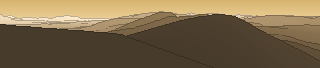
From up here 48 named peaks are in sight. The highest: Mont Tendre, 1679 m. The most distant: Gros Crétet, 53.3 km away.
The highest peaks in view
- Mont Tendre
- Chasseral
- Petites Roches
- Grand Cunay
- Aiguilles de Baulmes
- Roches Blanches
- Mont de la Maya
- Le Soliat
- Le Mont d'Or
- le Mont d'Or
- Mont Racine
- Tête de Ran
About Le Chasseron
Le Chasseron is a 1607 m peak in Schweiz, close to Mont Châteleu. The view reaches as far as Mont Tendre at 1679 m. The marked path to the top is graded T1 hiking on the SAC scale. Plan your route to Le Chasseron free of charge with Peakflow: real paths, elevation profile, weather and an offline map.
Where the peak stands
Peaks nearby
Plan your tour with Peakflow
Routes on real paths, a colour elevation profile, weather windows, water sources, snow cover and GPX export – free, no ads, no subscription.
Plan your tour to Le Chasseron →