What you see from the summit
The full 360-degree view from Stritkopf, computed from the elevation model and labelled with the names of the peaks you can see. Drag the image sideways; the slider hides the far distance.
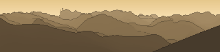
From up here 133 named peaks are in sight. The highest: Piz Linard, 3410 m. The most distant: Parpaner Rothorn, 50.4 km away.
The highest peaks in view
- Piz Linard
- Mittleres Fluchthorn
- Piz Buin
- Kleiner Piz Buin
- Silvrettahorn
- Nördliche Augstenspitze
- Schneeglocke
- Vorderes Plattenhorn
- Östliche Schnapfenspitze
- Signalhorn
- Hinteres Plattenhorn
- Dreiländerspitze
About Stritkopf
Stritkopf is a 2604 m two-thousander in Vorarlberg, close to Östlicher Valschavielberg, Albonakopf, Westlicher Valschavielerberg. The view reaches as far as Piz Linard at 3410 m. No marked trail reaches the summit itself – the last section needs alpine experience. Plan your route to Stritkopf free of charge with Peakflow: real paths, elevation profile, weather and an offline map.
Where the peak stands
Peaks nearby
Plan your tour with Peakflow
Routes on real paths, a colour elevation profile, weather windows, water sources, snow cover and GPX export – free, no ads, no subscription.
Plan your tour to Stritkopf →