Das sehen Sie vom Gipfel
Der Rundblick vom Castello über volle 360 Grad, aus dem Höhenmodell gerechnet und mit den Namen der sichtbaren Gipfel beschriftet. Ziehen Sie das Bild zur Seite, der Regler blendet die Ferne aus.
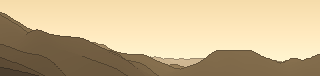
Von hier aus sind 108 benannte Gipfel zu sehen. Der höchste: Anticima Ovest, 2885 m. Der fernste: Anticima Ovest, 39,7 km Luftlinie.
Die höchsten Gipfel im Blickfeld
- Anticima Ovest
- Corno delle Pile
- Monte Listino
- Corno di Sensìpie
- Monte Monoccola
- Monte Boia
- Presolana Centrale
- Pizzo Camino
- Presolana Orientale
- Presolana di Castione
Was in welcher Richtung zu sehen ist
Totem di Parè (1708 m, 1,4 km).
Presolana Centrale (2517 m, 7,4 km), Pizzo Camino (2491 m, 16,3 km), Presolana Orientale (2490 m, 7,8 km), Presolana di Castione (2474 m, 6,7 km), Cima Moren (2417 m, 15,9 km), Presolana del Prato (2405 m, 7,2 km), Monte Visolo (2370 m, 7,9 km), Torrione Scandella (2320 m, 7,1 km) und 5 weitere.
Anticima Ovest (2885 m, 39,7 km), Corno delle Pile (2810 m, 36,3 km), Monte Listino (2749 m, 36,3 km), Corno di Sensìpie (2721 m, 37,1 km), Monte Monoccola (2684 m, 36,7 km), Monte Boia (2582 m, 38,5 km), Cima di Mezzamalga (2455 m, 34,2 km), Costone di Valbona (2415 m, 31,1 km) und 16 weitere.
Dosso Pedalta (1957 m, 20,8 km), Monte Alto (1721 m, 8,8 km), La Testata (1470 m, 22,2 km), Monte Colombina (1458 m, 8,2 km), Monte Cornet (1431 m, 5,6 km), Punta Co de Soch (1429 m, 7,2 km), Punta Vallerina (1403 m, 5,8 km), Punta Almana (1390 m, 25,1 km) und 8 weitere.
Monte Fogarolo (1526 m, 8,2 km), Monte Alto di Avene (1419 m, 8,7 km), Monte Grione (1381 m, 11,1 km), Monte Barzena (1379 m, 11,1 km), Monte Sparavera (1369 m, 11,8 km), Corna dei Fondi (1336 m, 16,5 km), Monte Bronzone (1334 m, 22,4 km), Monte Sicolo (1273 m, 16,3 km) und 16 weitere.
Pizzo Formico (1636 m, 8,8 km), Montagnina (1598 m, 8,3 km), Monte Segredònt (1548 m, 16,6 km), Monte Poieto (1360 m, 20,6 km), Cima di Cavlera (1320 m, 15 km), Cima di Tisa (1317 m, 14,8 km), Corno Guazza (1270 m, 9,6 km), Monte Castello (1208 m, 15,3 km) und 9 weitere.
Monte Secco Seriano (2266 m, 9 km), Cima Foppazzi (2093 m, 13 km), Cima di Grem (2049 m, 13,3 km), Monte Alben (2019 m, 17,3 km), Monte Golla (1983 m, 12,2 km), Cima della Croce (1975 m, 17,4 km), Cima Vaccaro (1958 m, 7,8 km), Cima Campelli (1889 m, 17,6 km) und 5 weitere.
Über den Castello
Der Castello ist ein 1271 m hoher Alpengipfel in der Schweiz, in der Nähe von Monte Cavallo, Monte Corno, Monte Madonnino. Der markierte Weg zum Gipfel hat die SAC-Schwierigkeit T1 Wandern. Plane deine Tour zum Castello kostenlos mit Peakflow – auf echten Wegen, mit Höhenprofil, Wetter und Offline-Karte.
Castello ist der größte der sechs Stadtteile (Sestiere) der italienischen Lagunenstadt Venedig. Er liegt im nordöstlichen Teil der Stadt und reicht fast bis zum Markusplatz.
Quelle der Beschreibung: Wikipedia (CC BY-SA), via Peakflow.
Wo der Gipfel steht
Gipfel in der Nähe

Häufige Fragen zum Castello
Welche Berge sieht man vom Castello?
Vom Gipfel aus sind 108 benannte Gipfel zu sehen. Die höchsten davon: Anticima Ovest (2885 m, 39,7 km), Corno delle Pile (2810 m, 36,3 km), Monte Listino (2749 m, 36,3 km), Corno di Sensìpie (2721 m, 37,1 km), Monte Monoccola (2684 m, 36,7 km). Der fernste sichtbare Gipfel ist Anticima Ovest in 39,7 km Luftlinie. Peakflow berechnet die Sicht aus dem Geländemodell und beschriftet sie im 360°-Rundblick.
Wie hoch ist der Castello?
Der Castello ist 1271 m hoch und liegt in der Schweiz. In der Umgebung liegen Monte Cavallo (1790 m), Monte Corno (1270 m), Monte Madonnino (2502 m).
Wie schwierig ist der Aufstieg zum Castello?
Der markierte Weg zum Castello ist nach der SAC-Bergwanderskala mit T1 Wandern bewertet. Das ist ein einfacher Wanderweg.
Tour planen mit Peakflow
Route auf echten Wegen, farbiges Höhenprofil, Wetterfenster, Wasserquellen, Schneelage und GPX-Export – kostenlos, ohne Werbung, ohne Abo.
Jetzt Tour zum Castello planen →
