Das sehen Sie vom Gipfel
Der Rundblick von der Cima Monticello (ovest) über volle 360 Grad, aus dem Höhenmodell gerechnet und mit den Namen der sichtbaren Gipfel beschriftet. Ziehen Sie das Bild zur Seite, der Regler blendet die Ferne aus.
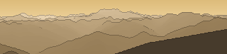
Von hier aus sind 159 benannte Gipfel zu sehen. Der höchste: Piz Bernina, 4049 m. Der fernste: Monte Disgrazia, 53,5 km Luftlinie.
Die höchsten Gipfel im Blickfeld
- Piz Bernina
- Pizzo Zupò
- Ortler - Ortles
- Königspitze - Gran Zebrù
- Piz Morteratsch
- Monte Zebrù
- Palon de la Mare
- Punta San Matteo
- Monte Disgrazia
- Thurwieserspitze - Punta Thurwieser
Was in welcher Richtung zu sehen ist
Ortler - Ortles (3905 m, 23,2 km), Monte Zebrù (3735 m, 21,6 km), Thurwieserspitze - Punta Thurwieser (3658 m, 21,3 km), Trafoier Eiswand - Cima di Trafoi (3565 m, 21,1 km), Cime di Campo (3480 m, 20,3 km), Geisterspitze - Punta degli Spiriti (3467 m, 20,9 km), Payerspitze - Punta Payer (3450 m, 20,5 km), Monte Cristallo (3439 m, 20,4 km) und 12 weitere.
Königspitze - Gran Zebrù (3851 m, 20,8 km), Palon de la Mare (3703 m, 17,7 km), Punta San Matteo (3678 m, 12 km), Punta Pedranzini (3599 m, 11,7 km), Pizzo Tresero (3594 m, 11,6 km), Monte Giumella (3593 m, 12,5 km), Cima Dosegù (3560 m, 11,7 km), Monte Pasquale (3553 m, 19 km) und 14 weitere.
Albiolino (2945 m, 10,5 km), Punta di Montozzo (2862 m, 9,5 km), Cima Forzellina (2829 m, 15,4 km), Cima Casaiole (2783 m, 10 km), Monte Tonale Occidentale (2694 m, 9,5 km), Cima Boai (2685 m, 17,4 km).
Cima Presanella (3557 m, 19,9 km), Carè Alto (3465 m, 25,6 km), Monte Gabbiolo (3455 m, 19,2 km), Dosson di Genova Meridionale (3439 m, 20,1 km), Monte Fumo (3408 m, 20,4 km), Corno di Cavento (3406 m, 22,5 km), Dosson di Genova Centrale (3394 m, 19,5 km), Crozzon di Làres (3354 m, 21,5 km) und 26 weitere.
Monte Adamello (3539 m, 17,9 km), Monte Falcone (3437 m, 17,9 km), Corno Bianco (3427 m, 17,8 km), Cima del Laghetto (3364 m, 18,3 km), Corno Baitone (3331 m, 15,5 km), Monte dei Frati (3285 m, 14,8 km), Roccia Baitone (3259 m, 16,5 km), Cima dei Laghi Gelati (3254 m, 15,9 km) und 14 weitere.
Cime del Tirlo (2911 m, 3,1 km), I Dossoni - Cima Nord (2910 m, 8,7 km), Corno del Tirlo (2785 m, 3,4 km), Corni di Cevole (2785 m, 5,8 km), Cime di Glere (2778 m, 2,5 km), Corni delle Valli (2757 m, 6 km), Monte Tremoncelli (2566 m, 6,6 km), Cima Cadi (2448 m, 15,1 km) und 3 weitere.
Piz Bernina (4049 m, 41,9 km), Pizzo Zupò (3996 m, 39,9 km), Piz Morteratsch (3751 m, 42,8 km), Monte Disgrazia (3678 m, 53,5 km), Piz Tschierva (3546 m, 44,3 km), Sasso Rosso (3488 m, 37,6 km), Pizzo Malenco (3438 m, 47,4 km), Piz Fora / Sassa di Fora (3364 m, 50,7 km) und 15 weitere.
Cima de' Piazzi (3439 m, 16,8 km), Cima Viola (3374 m, 20,6 km), Cima Settentrionale di Lago Spalmo (3356 m, 20,5 km), Corni di Verva (3335 m, 17,8 km), Piz Paradisin (3302 m, 28,1 km), Pizzo di Dosdè (3280 m, 19,9 km), Cima di Lago Spalmo Orientale - anticima nord (3262 m, 19,8 km), Monte Val Nera (3182 m, 27,5 km) und 13 weitere.
Über die Cima Monticello (ovest)
Die Cima Monticello (ovest) ist ein 3162 m hoher Dreitausender in Südtirol, in der Nähe von Piramide di Somalbosco, Punta di Pietra Rossa, Cima di Savoretta. Der markierte Weg zum Gipfel hat die SAC-Schwierigkeit T3 anspruchsvolles Bergwandern. Plane deine Tour zur Cima Monticello (ovest) kostenlos mit Peakflow – auf echten Wegen, mit Höhenprofil, Wetter und Offline-Karte.
Cima Monticello (ovest) ist ein Dreitausender in Südtirol und bietet eindrucksvolle Hochgebirgslandschaft mit Weitblick über die umliegenden Gipfel.
Quelle der Beschreibung: Wikipedia (CC BY-SA), via Peakflow.
Wo der Gipfel steht
Gipfel in der Nähe

Häufige Fragen zur Cima Monticello (ovest)
Welche Berge sieht man von der Cima Monticello (ovest)?
Vom Gipfel aus sind 159 benannte Gipfel zu sehen. Die höchsten davon: Piz Bernina (4049 m, 41,9 km), Pizzo Zupò (3996 m, 39,9 km), Ortler - Ortles (3905 m, 23,2 km), Königspitze - Gran Zebrù (3851 m, 20,8 km), Piz Morteratsch (3751 m, 42,8 km). Der fernste sichtbare Gipfel ist Monte Disgrazia in 53,5 km Luftlinie. Peakflow berechnet die Sicht aus dem Geländemodell und beschriftet sie im 360°-Rundblick.
Wie hoch ist die Cima Monticello (ovest)?
Die Cima Monticello (ovest) ist 3162 m hoch und liegt in Südtirol. In der Umgebung liegen Piramide di Somalbosco (3087 m), Punta di Pietra Rossa (3275 m), Cima di Savoretta (3053 m).
Wie schwierig ist der Aufstieg zur Cima Monticello (ovest)?
Der markierte Weg zur Cima Monticello (ovest) ist nach der SAC-Bergwanderskala mit T3 anspruchsvolles Bergwandern bewertet. Das verlangt Trittsicherheit, Schwindelfreiheit und Erfahrung im Gebirge.
Tour planen mit Peakflow
Route auf echten Wegen, farbiges Höhenprofil, Wetterfenster, Wasserquellen, Schneelage und GPX-Export – kostenlos, ohne Werbung, ohne Abo.
Jetzt Tour zur Cima Monticello (ovest) planen →
