Das sehen Sie vom Gipfel
Der Rundblick vom Monte Bello über volle 360 Grad, aus dem Höhenmodell gerechnet und mit den Namen der sichtbaren Gipfel beschriftet. Ziehen Sie das Bild zur Seite, der Regler blendet die Ferne aus.
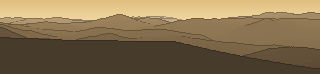
Von hier aus sind 145 benannte Gipfel zu sehen. Der höchste: Monte Acuto, 1669 m. Der fernste: Monte Tezino, 55 km Luftlinie.
Die höchsten Gipfel im Blickfeld
- Monte Acuto
- Monte Falco
- Pratomagno
- Monte Cucco
- Poggio Massarecci
- Monte Nerone
- Pian delle Fontanelle
- Poggio delle Portacce
- Poggio della Risala
- Monte dei Frati
Was in welcher Richtung zu sehen ist
Monte Simoncello (1220 m, 9,8 km), Monte Canale (1052 m, 11,7 km), Monte della Scura (1047 m, 7,8 km), Poggio delle Campane (1035 m, 5,1 km), Monte Ercole (938 m, 20,4 km), Monte Maggio (899 m, 5,2 km), Monte San Silvestro (884 m, 19,3 km), Monte Zuccola (868 m, 18,6 km) und 4 weitere.
Monte Carpegna (1415 m, 14,7 km), Testa del Monte (1406 m, 15,3 km), Monte Carpegna Est (1406 m, 14,8 km), Sasso Simone (1204 m, 9,5 km), Monte dei Corrieri (1016 m, 10 km), Lo Spicchio (921 m, 5,7 km), Monte San Paolo (864 m, 26,1 km), Monte Petralla (754 m, 9,8 km) und 3 weitere.
Monte Paganuccio (977 m, 40,9 km), Monte Montiego (975 m, 24,2 km), Monte Pietralata (889 m, 37,8 km), Monte Dese (888 m, 4,7 km), Monte Cossante (857 m, 5,6 km), Cima Castiglioni (834 m, 24,4 km), Monte della Rocca (806 m, 8,4 km), Monte Alto (781 m, 3,4 km) und 5 weitere.
Monte Acuto (1669 m, 42 km), Monte Cucco (1566 m, 53,3 km), Monte Nerone (1525 m, 26 km), Monte Motette (1331 m, 48,8 km), Monte Sodello (1301 m, 28,1 km), Pian della Serra (1020 m, 33,6 km), Monte Foce (982 m, 43,8 km), Monte Valmeronte (978 m, 14,7 km) und 21 weitere.
Monte Sodo Pulito (1225 m, 7,4 km), Poggio del Romito (1196 m, 9,9 km), Poggio i Tre Termini (1171 m, 8,3 km), Monte Sant' Antonio (1169 m, 9,7 km), Poggio Pratin del Bravo (1130 m, 9 km), il Montaccio (1072 m, 10,5 km), Sbocco le Macinelle (1031 m, 10 km), Sbocco di Gambino (977 m, 11,3 km) und 12 weitere.
Monte Maggiore (1384 m, 6,4 km), Alpe della Luna (1363 m, 6,8 km), Poggio Alto (1252 m, 6,9 km), Poggio dell'Appione (1152 m, 5,8 km), Poggio Valalfio (1120 m, 5,4 km), Poggio Ciabattine (1104 m, 4,7 km), Monte Finocchio (1074 m, 6 km), Poggio della Regina (1041 m, 0,7 km) und 3 weitere.
Pratomagno (1592 m, 48,2 km), Poggio Massarecci (1548 m, 46,1 km), Poggio delle Portacce (1508 m, 48 km), Poggio della Risala (1484 m, 53,7 km), Monte dei Frati (1453 m, 6,9 km), Monte Secchieta (1450 m, 54,3 km), Poggio Tre Confini (1438 m, 50,9 km), Monte Penna (1283 m, 24,9 km) und 13 weitere.
Monte Falco (1657 m, 48,3 km), Pian delle Fontanelle (1512 m, 48,9 km), Monte Fumaiolo (1406 m, 18,4 km), Monte Aquilone (1354 m, 16,1 km), Il Monticino (1348 m, 19,1 km), Poggio alle Capre (1330 m, 34,3 km), Poggio del Passino (1317 m, 16,4 km), Montalto (1302 m, 25,6 km) und 20 weitere.
Über den Monte Bello
Der Monte Bello ist ein 1073 m hoher Alpengipfel in den Alpen. Der markierte Weg zum Gipfel hat die SAC-Schwierigkeit T1 Wandern. Plane deine Tour zum Monte Bello kostenlos mit Peakflow – auf echten Wegen, mit Höhenprofil, Wetter und Offline-Karte.
Montebello oder Monte Bello heißen folgende geographische Objekte: Gebirgslage: Montebello 1958 m ü. M. im Val Bernina, Aussichtspunkt nahe der Montebello-Kurve der Berninabahn Gemeinden, Orte: Monte Bello (Tucumán), Ort in der Provinz Tucumán, Argentinien Montebello della Battaglia, italienische Gemeinde in der Lombardei Montebello Ionico, it...
Quelle der Beschreibung: Wikipedia (CC BY-SA), via Peakflow.
Wo der Gipfel steht
Häufige Fragen zum Monte Bello
Welche Berge sieht man vom Monte Bello?
Vom Gipfel aus sind 145 benannte Gipfel zu sehen. Die höchsten davon: Monte Acuto (1669 m, 42 km), Monte Falco (1657 m, 48,3 km), Pratomagno (1592 m, 48,2 km), Monte Cucco (1566 m, 53,3 km), Poggio Massarecci (1548 m, 46,1 km). Der fernste sichtbare Gipfel ist Monte Tezino in 55 km Luftlinie. Peakflow berechnet die Sicht aus dem Geländemodell und beschriftet sie im 360°-Rundblick.
Wie hoch ist der Monte Bello?
Der Monte Bello ist 1073 m hoch und liegt in den Alpen.
Wie schwierig ist der Aufstieg zum Monte Bello?
Der markierte Weg zum Monte Bello ist nach der SAC-Bergwanderskala mit T1 Wandern bewertet. Das ist ein einfacher Wanderweg.
Tour planen mit Peakflow
Route auf echten Wegen, farbiges Höhenprofil, Wetterfenster, Wasserquellen, Schneelage und GPX-Export – kostenlos, ohne Werbung, ohne Abo.
Jetzt Tour zum Monte Bello planen →
