Das sehen Sie vom Gipfel
Der Rundblick vom Monte Bello über volle 360 Grad, aus dem Höhenmodell gerechnet und mit den Namen der sichtbaren Gipfel beschriftet. Ziehen Sie das Bild zur Seite, der Regler blendet die Ferne aus.
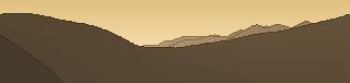
Von hier aus sind 88 benannte Gipfel zu sehen. Der höchste: Pointe Marguareis / Cima Marguarèis, 2651 m. Der fernste: Monte Ceppo, 24,1 km Luftlinie.
Die höchsten Gipfel im Blickfeld
- Pointe Marguareis / Cima Marguarèis
- Monte Mongioie
- Cima delle Saline
- Cima Pian Ballaùr
- Monte Ballaùr
- Bric Conoia
- Rocche del Garbo
- Cima delle Roccate
- Pizzo d'Ormea
- Cima di Pian Comune
Was in welcher Richtung zu sehen ist
Monte Armetta (1739 m, 4 km), Monte Pesauto (1544 m, 3,2 km).
Monte Galero (1708 m, 7,7 km), Monte Dubasso (1538 m, 3,6 km), Monte Fuetto (1531 m, 8,2 km), Rocca della Spina (1487 m, 4,2 km), Pizzo delle Penne (1402 m, 8,4 km), Pizzo Castellino (1397 m, 8,3 km), Monte Carmo (1389 m, 20,4 km), Rocca Battaglina (1367 m, 4,4 km) und 4 weitere.
Bric Ciazzalunga (1216 m, 19,9 km), Monte Castellermo (1087 m, 7,8 km), Monte Ravinet (1061 m, 20,4 km), Monte Alpe (1056 m, 10,9 km), Monte Lapeu (1004 m, 7,6 km), Rocca del Bozzaro (947 m, 2,9 km), Montenero (853 m, 10,4 km), Monte Torretta (852 m, 5,4 km) und 5 weitere.
Monte Ceresa (913 m, 15,2 km), Monte Riondo (776 m, 8,4 km), Monte Carpanea (607 m, 12,9 km), Monte Tirasso (586 m, 17,8 km), Monte Rovona (561 m, 12,6 km), Monte Carchera (510 m, 14,3 km), Monte Villa (339 m, 11 km), Poggio Carmo (331 m, 16,6 km) und 1 weitere.
Monte Moro (1184 m, 18,7 km), Monte Faudo (1149 m, 22,5 km), Monte Cucco (1144 m, 1,5 km), Monte Frascinello (1120 m, 4,3 km), Monte le Ciazze (1088 m, 17 km), Punta Alto (1082 m, 3,4 km), Monte Follia (1031 m, 23,2 km), Monte Torre (989 m, 14,6 km) und 7 weitere.
Monte Monega (1887 m, 14,4 km), Poggio Pian del Latte (1778 m, 13,2 km), Monte Bussana (1701 m, 14,9 km), Poggio Buoi di Raxin (1700 m, 14,7 km), Cima di Donzella (1636 m, 14,9 km), Monte Ceppo (1627 m, 24,1 km), Carmo di Brocchi (1610 m, 15,7 km), Monte Arborea (1549 m, 15,6 km) und 12 weitere.
Pointe Marguareis / Cima Marguarèis (2651 m, 23 km), Cima Pian Ballaùr (2604 m, 20,1 km), Monte Ballaùr (2579 m, 20 km), Cima di Gaina / Cime de la Galine (2400 m, 22,9 km), Il Ferà (2260 m, 20,4 km), Rocca delle Penne (1501 m, 1,6 km), Rocca Tramontina (1495 m, 1 km).
Monte Mongioie (2630 m, 15,7 km), Cima delle Saline (2612 m, 19,4 km), Bric Conoia (2524 m, 13,7 km), Rocche del Garbo (2477 m, 15,7 km), Cima delle Roccate (2476 m, 13,2 km), Pizzo d'Ormea (2476 m, 12,2 km), Cima di Pian Comune (2407 m, 17,3 km), Bricchi Neri (2296 m, 15,9 km) und 2 weitere.
Über den Monte Bello
Der Monte Bello ist ein 1315 m hoher Alpengipfel in den Alpen. Plane deine Tour zum Monte Bello kostenlos mit Peakflow – auf echten Wegen, mit Höhenprofil, Wetter und Offline-Karte.
Montebello oder Monte Bello heißen folgende geographische Objekte: Gebirgslage: Montebello 1958 m ü. M. im Val Bernina, Aussichtspunkt nahe der Montebello-Kurve der Berninabahn Gemeinden, Orte: Monte Bello (Tucumán), Ort in der Provinz Tucumán, Argentinien Montebello della Battaglia, italienische Gemeinde in der Lombardei Montebello Ionico, it...
Quelle der Beschreibung: Wikipedia (CC BY-SA), via Peakflow.
Wo der Gipfel steht
Häufige Fragen zum Monte Bello
Welche Berge sieht man vom Monte Bello?
Vom Gipfel aus sind 88 benannte Gipfel zu sehen. Die höchsten davon: Pointe Marguareis / Cima Marguarèis (2651 m, 23 km), Monte Mongioie (2630 m, 15,7 km), Cima delle Saline (2612 m, 19,4 km), Cima Pian Ballaùr (2604 m, 20,1 km), Monte Ballaùr (2579 m, 20 km). Der fernste sichtbare Gipfel ist Monte Ceppo in 24,1 km Luftlinie. Peakflow berechnet die Sicht aus dem Geländemodell und beschriftet sie im 360°-Rundblick.
Wie hoch ist der Monte Bello?
Der Monte Bello ist 1315 m hoch und liegt in den Alpen.
Tour planen mit Peakflow
Route auf echten Wegen, farbiges Höhenprofil, Wetterfenster, Wasserquellen, Schneelage und GPX-Export – kostenlos, ohne Werbung, ohne Abo.
Jetzt Tour zum Monte Bello planen →
