Das sehen Sie vom Gipfel
Der Rundblick vom Monte Bello über volle 360 Grad, aus dem Höhenmodell gerechnet und mit den Namen der sichtbaren Gipfel beschriftet. Ziehen Sie das Bild zur Seite, der Regler blendet die Ferne aus.
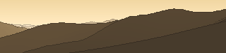
Von hier aus sind 82 benannte Gipfel zu sehen. Der höchste: Monte Velino, 2486 m. Der fernste: Monte Forte, 54,7 km Luftlinie.
Die höchsten Gipfel im Blickfeld
- Monte Velino
- Monte di Sevice
- Murolungo
- Monte Viglio
- Monte Morrone
- Gendarme
- Monte Passeggio
- Vado della Cornacchia
- Monte Fragara
- Monte Cava
Was in welcher Richtung zu sehen ist
Monte Velino (2486 m, 39 km), Monte di Sevice (2355 m, 39,9 km), Murolungo (2184 m, 42,8 km), Monte Morrone (2141 m, 45 km), Monte Cava (2000 m, 49,8 km), Monte Prato (1807 m, 2,6 km).
Monte Cappello (1981 m, 1,4 km).
Monte Passeggio (2064 m, 2,4 km), Vado della Cornacchia (2016 m, 2,4 km), Monte Fragara (2005 m, 2,5 km), Monte Brecciaro (1885 m, 2 km).
Cima Costa dei fiori (1985 m, 2,2 km), Monte Scalelle (1837 m, 2,5 km), Monte Pedicinetto (1776 m, 6,1 km), Monte delle Pratelle (1750 m, 0,8 km), Monte Pedicino (1737 m, 6,6 km), Punta dell'Ortica (1731 m, 6,3 km), Monte Cairo (1669 m, 38,4 km), Omo di Cairo (1529 m, 37,3 km).
Monte Pontecorvo (1576 m, 3,4 km), Monte i Tre Confini (1491 m, 2,7 km), Monte Forte (1316 m, 54,7 km), Monte Revole (1285 m, 53 km), Monte Faggeto (1256 m, 49,1 km), Monte Chiavica (1195 m, 54 km), Monte Viola (1173 m, 54,2 km), Puntone Mugliera (1137 m, 5,7 km) und 16 weitere.
Monte Semprevisa (1536 m, 39,6 km), Monte Gemma (1457 m, 32,3 km), Monte Ardicara (1443 m, 40,3 km), Monte La Croce (1431 m, 39,5 km), Monte Lupone (1378 m, 42,6 km), Monte Erdigheta (1336 m, 39,4 km), Monte Ardigheta (1237 m, 43,2 km), Monte Filaro (1230 m, 30,2 km) und 6 weitere.
Monte La Monna (1952 m, 7 km), Monte Fanfilli (1952 m, 6,2 km), Cima del Diavolo (1948 m, 6,9 km), Monte Vermicano (1948 m, 9,6 km), Monte Ortara (1908 m, 5,8 km), Monte Rotonaria (1750 m, 5,5 km), Monte Peccia (1568 m, 3,6 km), Monte Rinsaturo (1166 m, 44,7 km) und 2 weitere.
Monte Viglio (2156 m, 11,5 km), Gendarme (2113 m, 11,7 km), Monte Crepacuore (1997 m, 9,5 km), Monte Pozzotello (1995 m, 8,1 km), Peschio della Cornacchia (1983 m, 8,9 km), Cima di Monna Moschino (1962 m, 11,2 km), Peschio delle Ciavole (1959 m, 8,1 km), Peschio delle Pelarelle (1914 m, 8,4 km) und 7 weitere.
Über den Monte Bello
Der Monte Bello ist ein 1796 m hoher Alpengipfel in den Alpen, in der Nähe von Monte Castello, Monte Rotondo, Gendarme. Plane deine Tour zum Monte Bello kostenlos mit Peakflow – auf echten Wegen, mit Höhenprofil, Wetter und Offline-Karte.
Montebello oder Monte Bello heißen folgende geographische Objekte: Gebirgslage: Montebello 1958 m ü. M. im Val Bernina, Aussichtspunkt nahe der Montebello-Kurve der Berninabahn Gemeinden, Orte: Monte Bello (Tucumán), Ort in der Provinz Tucumán, Argentinien Montebello della Battaglia, italienische Gemeinde in der Lombardei Montebello Ionico, it...
Quelle der Beschreibung: Wikipedia (CC BY-SA), via Peakflow.
Wo der Gipfel steht
Gipfel in der Nähe

Häufige Fragen zum Monte Bello
Welche Berge sieht man vom Monte Bello?
Vom Gipfel aus sind 82 benannte Gipfel zu sehen. Die höchsten davon: Monte Velino (2486 m, 39 km), Monte di Sevice (2355 m, 39,9 km), Murolungo (2184 m, 42,8 km), Monte Viglio (2156 m, 11,5 km), Monte Morrone (2141 m, 45 km). Der fernste sichtbare Gipfel ist Monte Forte in 54,7 km Luftlinie. Peakflow berechnet die Sicht aus dem Geländemodell und beschriftet sie im 360°-Rundblick.
Wie hoch ist der Monte Bello?
Der Monte Bello ist 1796 m hoch und liegt in den Alpen. In der Umgebung liegen Monte Castello (1093 m), Monte Rotondo (1811 m), Gendarme (2113 m).
Tour planen mit Peakflow
Route auf echten Wegen, farbiges Höhenprofil, Wetterfenster, Wasserquellen, Schneelage und GPX-Export – kostenlos, ohne Werbung, ohne Abo.
Jetzt Tour zum Monte Bello planen →
