Das sehen Sie vom Gipfel
Der Rundblick vom Monte Castello über volle 360 Grad, aus dem Höhenmodell gerechnet und mit den Namen der sichtbaren Gipfel beschriftet. Ziehen Sie das Bild zur Seite, der Regler blendet die Ferne aus.
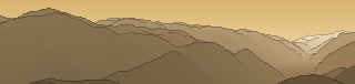
Von hier aus sind 164 benannte Gipfel zu sehen. Der höchste: Carè Alto, 3465 m. Der fernste: Cima Foppazzi, 53,8 km Luftlinie.
Die höchsten Gipfel im Blickfeld
- Carè Alto
- Monte Folletto
- Anticima Ovest
- Cima Uccia
- Monte Frerone
- Monte Bruffione
- Monte Cadria
- Monte Colombine
- Cima Prà della Baziva
- Costone delle Cornelle
Was in welcher Richtung zu sehen ist
Carè Alto (3465 m, 47,5 km), Monte Folletto (3336 m, 48,9 km), Anticima Ovest (2885 m, 36,4 km), Cima Uccia (2678 m, 36,7 km), Monte Frerone (2673 m, 28,1 km), Monte Bruffione (2665 m, 27,8 km), Monte Colombine (2217 m, 18,4 km), Costone delle Cornelle (2201 m, 21,1 km) und 26 weitere.
Monte Cadria (2250 m, 33,5 km), Monte Cengledino (2145 m, 42,2 km), Monte Caplone (1976 m, 19,4 km), Cima Tombea (1946 m, 18,8 km), Cima Spessa (1821 m, 18,1 km), Cima di Berlinghera (1775 m, 20,2 km), Monte Stigolo (1699 m, 23 km), Monte Cingla (1670 m, 13,9 km) und 20 weitere.
Cima Prà della Baziva (2207 m, 31,1 km), Cima Telegrafo (2200 m, 30 km), Punta Pettorina (2192 m, 30,7 km), Vetta delle Buse (2155 m, 29,7 km), Monte Altissimo di Nago (2079 m, 36,8 km), Cima Costabella (2053 m, 29,1 km), Monte Pizzocolo (1581 m, 11,7 km), Dosso le Prade (1511 m, 10,5 km) und 14 weitere.
Corna Ceresola (868 m, 6,3 km), Monte Sercine (820 m, 4,3 km), Monte Coro (753 m, 7,2 km), Corna Bussarola (604 m, 8,6 km), Monte Misole (601 m, 4,8 km), Monte Croce (182 m, 15 km).
Dosso Covolo (757 m, 6,6 km), Monte Acuto (745 m, 7,5 km), Cima Maidone (713 m, 3,2 km), Monte Rasina (493 m, 6,6 km), Monte Mignon (485 m, 6,6 km), Monte San Pietro (290 m, 16 km).
Monte Doppo (1216 m, 12,8 km), Monte Ucia (1168 m, 13,5 km), Moncaldo (862 m, 9,6 km), Monte Pino (803 m, 11 km), Monte Sete (802 m, 10,6 km), Monte Gabbiole (801 m, 10,8 km), Monte Cornisello (794 m, 10,7 km), Monte Cler (781 m, 9,3 km) und 7 weitere.
Dosso Pedalta (1957 m, 23,4 km), Monte Guglielmo (1948 m, 22,6 km), Corna Tiragna (1857 m, 22 km), Medeletto (1567 m, 23,9 km), Monte Bifo (1475 m, 19,8 km), Corna di Savallo (1436 m, 10,5 km), Punta Almana (1390 m, 22,8 km), Monte Lividino (1361 m, 19,4 km) und 18 weitere.
Cima Foppazzi (2093 m, 53,8 km), Corna Blacca (2006 m, 11,8 km), Dosso Beccheria di Bassinale (1972 m, 22,6 km), Dosso della Croce (1930 m, 19,2 km), Colma di Marucolo (1857 m, 22,1 km), Monte Campione (1832 m, 21,9 km), Monte Splaza (1826 m, 22,6 km), Dosso Rotondo (1820 m, 22,1 km) und 19 weitere.
Über den Monte Castello
Der Monte Castello ist ein 1071 m hoher Alpengipfel in den Alpen, in der Nähe von Monte Pizzocolo. Der markierte Weg zum Gipfel hat die SAC-Schwierigkeit T1 Wandern. Plane deine Tour zum Monte Castello kostenlos mit Peakflow – auf echten Wegen, mit Höhenprofil, Wetter und Offline-Karte.
Monte Castello steht für:Monte Castello (Fanesgruppe), Berg in den Dolomiten, Italien Monte Castello (Apennin), Berg im Apennin, Italien Monte Castello, Berg in der Lombardei, Italien Monte Castello di Vibio, Gemeinde in der Region Umbrien, Italien Schlacht von Monte Castello
Quelle der Beschreibung: Wikipedia (CC BY-SA), via Peakflow.
Wo der Gipfel steht
Gipfel in der Nähe

Häufige Fragen zum Monte Castello
Welche Berge sieht man vom Monte Castello?
Vom Gipfel aus sind 164 benannte Gipfel zu sehen. Die höchsten davon: Carè Alto (3465 m, 47,5 km), Monte Folletto (3336 m, 48,9 km), Anticima Ovest (2885 m, 36,4 km), Cima Uccia (2678 m, 36,7 km), Monte Frerone (2673 m, 28,1 km). Der fernste sichtbare Gipfel ist Cima Foppazzi in 53,8 km Luftlinie. Peakflow berechnet die Sicht aus dem Geländemodell und beschriftet sie im 360°-Rundblick.
Wie hoch ist der Monte Castello?
Der Monte Castello ist 1071 m hoch und liegt in den Alpen. In der Umgebung liegen Monte Pizzocolo (1581 m).
Wie schwierig ist der Aufstieg zum Monte Castello?
Der markierte Weg zum Monte Castello ist nach der SAC-Bergwanderskala mit T1 Wandern bewertet. Das ist ein einfacher Wanderweg.
Tour planen mit Peakflow
Route auf echten Wegen, farbiges Höhenprofil, Wetterfenster, Wasserquellen, Schneelage und GPX-Export – kostenlos, ohne Werbung, ohne Abo.
Jetzt Tour zum Monte Castello planen →
