Das sehen Sie vom Gipfel
Der Rundblick vom Monte Castello über volle 360 Grad, aus dem Höhenmodell gerechnet und mit den Namen der sichtbaren Gipfel beschriftet. Ziehen Sie das Bild zur Seite, der Regler blendet die Ferne aus.
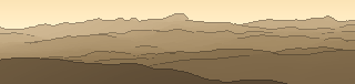
Von hier aus sind 114 benannte Gipfel zu sehen. Der höchste: Corno Grande - Vetta Occidentale, 2912 m. Der fernste: Monte Gabbia, 52,8 km Luftlinie.
Die höchsten Gipfel im Blickfeld
- Corno Grande - Vetta Occidentale
- Monte Amaro
- Monte Focalone
- Monte Tre Portoni
- Pescofalcone
- Monte Macellaro
- Pizzo d'Intermesoli
- Monte Corvo
- Cima delle Murelle
- Monte Camicia
Was in welcher Richtung zu sehen ist
Corno Grande - Vetta Occidentale (2912 m, 34,3 km), Pizzo d'Intermesoli (2635 m, 35,4 km), Monte Corvo (2623 m, 36,9 km), Monte Camicia (2564 m, 31 km), Monte Prena (2561 m, 30,9 km), Cima Ovest del Monte Corvo (2533 m, 37,6 km), Pizzo Cefalone (2533 m, 33,1 km), Cima Caitora (2425 m, 33,6 km) und 22 weitere.
Monte Guardiola (1808 m, 28,8 km), Monte Cappucciata (1801 m, 23,1 km), Monte Meta (1784 m, 24,6 km), Monte Scarafano (1432 m, 21,1 km), Monte Picca (1405 m, 19,3 km), Monte Offermo (1303 m, 6,7 km), Monte Sant'Erasmo (1277 m, 6,6 km), Monte Motola (1249 m, 8,4 km) und 5 weitere.
Monte Amaro (2793 m, 37,7 km), Monte Focalone (2676 m, 39,5 km), Monte Tre Portoni (2673 m, 37,7 km), Pescofalcone (2646 m, 37,1 km), Monte Macellaro (2646 m, 39,6 km), Cima delle Murelle (2596 m, 40,9 km), Cima di Fondo di Femmina Morta (2487 m, 39,7 km), Tavola Rotonda (2403 m, 39,8 km) und 11 weitere.
Monte Greco (2285 m, 50,2 km), Serra Rocca Chiarano (2262 m, 46,9 km), Monte Marsicano (2245 m, 44,2 km), Punta della Peltrara (2201 m, 33,7 km), Monte Genzana (2170 m, 31,6 km), Monte Porrara (2137 m, 43,6 km), Monte Rotella (2127 m, 40,5 km), Serra Carapale Sud (2106 m, 35,3 km) und 18 weitere.
Altare della Neviera (2200 m, 3,5 km), Monte di Canale (2151 m, 3,8 km), Monte San Nicola (2012 m, 5,1 km).
Monte Sirente (2348 m, 3,5 km), La Castellina (2277 m, 3,4 km), Punta Macerola (2258 m, 4,1 km), Il Tempio (2091 m, 3,4 km), Colle Ialone (1505 m, 2,3 km).
Cimata di Pezza - ovest (2132 m, 19,7 km), Sperone dei Tiburtini (2128 m, 5,1 km), Cimata di Pezza - est (2074 m, 18,8 km), Monte Rotondo (2064 m, 13,7 km).
Pizzo di Camarda (2332 m, 35,7 km), Monte Ienca (2208 m, 36,7 km), Monte Cagno (2153 m, 17,1 km), Monte Cefalone (2142 m, 19 km), Monte San Franco (2132 m, 39,2 km), Cima di Fossa Palomba (2120 m, 20 km), Anticima Est Monte Cefalone (2086 m, 17,8 km), Colle delle Macchie (1592 m, 38,9 km) und 6 weitere.
Über den Monte Castello
Der Monte Castello ist ein 1403 m hoher Alpengipfel in den Alpen, in der Nähe von Monte Urano. Plane deine Tour zum Monte Castello kostenlos mit Peakflow – auf echten Wegen, mit Höhenprofil, Wetter und Offline-Karte.
Monte Castello steht für:Monte Castello (Fanesgruppe), Berg in den Dolomiten, Italien Monte Castello (Apennin), Berg im Apennin, Italien Monte Castello, Berg in der Lombardei, Italien Monte Castello di Vibio, Gemeinde in der Region Umbrien, Italien Schlacht von Monte Castello
Quelle der Beschreibung: Wikipedia (CC BY-SA), via Peakflow.
Wo der Gipfel steht
Gipfel in der Nähe

Häufige Fragen zum Monte Castello
Welche Berge sieht man vom Monte Castello?
Vom Gipfel aus sind 114 benannte Gipfel zu sehen. Die höchsten davon: Corno Grande - Vetta Occidentale (2912 m, 34,3 km), Monte Amaro (2793 m, 37,7 km), Monte Focalone (2676 m, 39,5 km), Monte Tre Portoni (2673 m, 37,7 km), Pescofalcone (2646 m, 37,1 km). Der fernste sichtbare Gipfel ist Monte Gabbia in 52,8 km Luftlinie. Peakflow berechnet die Sicht aus dem Geländemodell und beschriftet sie im 360°-Rundblick.
Wie hoch ist der Monte Castello?
Der Monte Castello ist 1403 m hoch und liegt in den Alpen. In der Umgebung liegen Monte Urano (1080 m).
Tour planen mit Peakflow
Route auf echten Wegen, farbiges Höhenprofil, Wetterfenster, Wasserquellen, Schneelage und GPX-Export – kostenlos, ohne Werbung, ohne Abo.
Jetzt Tour zum Monte Castello planen →
