Das sehen Sie vom Gipfel
Der Rundblick vom Monte Corno über volle 360 Grad, aus dem Höhenmodell gerechnet und mit den Namen der sichtbaren Gipfel beschriftet. Ziehen Sie das Bild zur Seite, der Regler blendet die Ferne aus.
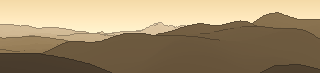
Von hier aus sind 94 benannte Gipfel zu sehen. Der höchste: Corno Grande - Vetta Occidentale, 2912 m. Der fernste: Monte Gennaro, 54,7 km Luftlinie.
Die höchsten Gipfel im Blickfeld
- Corno Grande - Vetta Occidentale
- Corno Piccolo
- Pizzo Cefalone
- Monte Aquila
- Monte Vettore
- Monte Gorzano
- Cima Lepri
- Pizzo di Sevo
- Pizzo di Moscio
- Cima della Laghetta Anticima Nord
Was in welcher Richtung zu sehen ist
Monte Vettore (2476 m, 42,3 km), Il Pizzo (2281 m, 42,9 km), Pizzitello (2221 m, 38 km), Monte Bove Sud (2169 m, 46,8 km), Macéra della Morte (2073 m, 39,4 km), Monte Pozzoni (1903 m, 23,3 km), Monte Laghetto (1836 m, 23,5 km), Monte Utero (1807 m, 28,4 km) und 12 weitere.
Corno Grande - Vetta Occidentale (2912 m, 53,2 km), Corno Piccolo (2655 m, 52,6 km), Pizzo Cefalone (2533 m, 50,3 km), Monte Aquila (2494 m, 53,7 km), Monte Gorzano (2458 m, 39,5 km), Cima Lepri (2445 m, 38,3 km), Pizzo di Sevo (2419 m, 37,3 km), Pizzo di Moscio (2411 m, 40,5 km) und 20 weitere.
Terminillo - Vetta Est (2216 m, 9,9 km), Vetta Sassetelli (2139 m, 9,3 km), Monte Terminilletto (2108 m, 10,2 km), Monte di Cambio (2081 m, 9 km), Monte Elefante (2015 m, 12 km), Cima Ultima (1985 m, 8,7 km), Monte I Porcini (1982 m, 9,2 km), Cima di Prato Cristoforo (1975 m, 10,5 km) und 8 weitere.
Colle Leporino (1756 m, 5,4 km), Cima d'Arme (1675 m, 3,8 km), Monte Castiglioni (1659 m, 1,8 km), Monti Versanello (1637 m, 2,3 km), Cima di Monte (1622 m, 4,3 km), Monte Palloroso (1591 m, 6,1 km), Monte Navegna (1508 m, 36,2 km), Monte Cerasa (1502 m, 4,7 km) und 10 weitere.
Monte Rosato (1510 m, 4,2 km), Monte Polino (1487 m, 3,6 km), Monte Tancia (1292 m, 28,4 km), Monte Pizzuto (1288 m, 28,5 km), Monte Macchia Gelata (1258 m, 27,2 km), Monte Porco Morto (1258 m, 25,6 km), Monte Menicoccio (1204 m, 29,5 km), Monte Macchia Porrara (1202 m, 25 km) und 4 weitere.
Über den Monte Corno
Der Monte Corno ist ein 1735 m hoher Alpengipfel in den Alpen, in der Nähe von Collelungo, Monte Piano, Monte Terminillo. Plane deine Tour zum Monte Corno kostenlos mit Peakflow – auf echten Wegen, mit Höhenprofil, Wetter und Offline-Karte.
Monte Corno ist der Name folgender geographischer Objekte:Monte Corno, 306 m, Ligurien, Italien Monte Corno, 1226, Grajische Alpen, Italien Monte Corno (Venetien), 1383 m, Venetien, Italien Monte Corno, 1505 m, Ligurien, Italien Monte Corno oder Trudner Horn, 1781 m, Südtirol und Trentino, Italien Monte Corno (Gardaseeberge), 1961 m, Trentino, I...
Quelle der Beschreibung: Wikipedia (CC BY-SA), via Peakflow.
Wo der Gipfel steht
Gipfel in der Nähe

Häufige Fragen zum Monte Corno
Welche Berge sieht man vom Monte Corno?
Vom Gipfel aus sind 94 benannte Gipfel zu sehen. Die höchsten davon: Corno Grande - Vetta Occidentale (2912 m, 53,2 km), Corno Piccolo (2655 m, 52,6 km), Pizzo Cefalone (2533 m, 50,3 km), Monte Aquila (2494 m, 53,7 km), Monte Vettore (2476 m, 42,3 km). Der fernste sichtbare Gipfel ist Monte Gennaro in 54,7 km Luftlinie. Peakflow berechnet die Sicht aus dem Geländemodell und beschriftet sie im 360°-Rundblick.
Wie hoch ist der Monte Corno?
Der Monte Corno ist 1735 m hoch und liegt in den Alpen. In der Umgebung liegen Collelungo (1652 m), Monte Piano (1790 m), Monte Terminillo (2217 m).
Tour planen mit Peakflow
Route auf echten Wegen, farbiges Höhenprofil, Wetterfenster, Wasserquellen, Schneelage und GPX-Export – kostenlos, ohne Werbung, ohne Abo.
Jetzt Tour zum Monte Corno planen →
