Das sehen Sie vom Gipfel
Der Rundblick vom Monte Matto über volle 360 Grad, aus dem Höhenmodell gerechnet und mit den Namen der sichtbaren Gipfel beschriftet. Ziehen Sie das Bild zur Seite, der Regler blendet die Ferne aus.
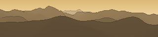
Von hier aus sind 151 benannte Gipfel zu sehen. Der höchste: Carè Alto, 3465 m. Der fernste: Cima Vicima, 54,7 km Luftlinie.
Die höchsten Gipfel im Blickfeld
- Carè Alto
- Monte Falcone
- Corno Bianco
- Corno di Cavento
- Monte Folletto
- II Gobba
- Vetta di Ron
- Cima Tosa
- Cima Vicima
- Cima di Forame
Was in welcher Richtung zu sehen ist
Monte Falcone (3437 m, 34,4 km), Corno Bianco (3427 m, 35,1 km), Punta Adami (3007 m, 34,3 km), Monte Serottini (2963 m, 48,5 km), Corno Orientale di Dois (2843 m, 19 km), Cornone di Blumone (2843 m, 11,9 km), Monte Masuccio (2816 m, 48 km), Corno delle Pile (2810 m, 18,2 km) und 28 weitere.
Carè Alto (3465 m, 32 km), Corno di Cavento (3406 m, 34,4 km), Monte Folletto (3336 m, 33,2 km), II Gobba (3259 m, 32,6 km), Cima Tosa (3136 m, 49,7 km), Cima Mandron (3040 m, 52,5 km), Cima Cop di Breguzzo (3003 m, 26,7 km), Cima Brenta Alta (2964 m, 51,4 km) und 17 weitere.
Monte Cadria (2250 m, 25,1 km), Costone di Dolò (2192 m, 7 km), Dosso del Matto (2102 m, 6,1 km), Monte Carena (1954 m, 6,5 km), Dosso delle Saette (1883 m, 18 km), Cima Spessa (1821 m, 15,4 km), Monte Stigolo (1699 m, 16,6 km), Rocca Fredda (1668 m, 15,6 km) und 1 weitere.
Cima Valdritta (Monte Baldo) (2218 m, 37,5 km), Cima Prà della Baziva (2207 m, 37,7 km), Cima Telegrafo (2200 m, 37,5 km), Cime Baremon (1770 m, 7,3 km), Monte Cingla (1670 m, 15,3 km), Bezplel (1540 m, 15 km), Cima Ora (1534 m, 8,7 km), Monte Manos (1516 m, 17,1 km) und 9 weitere.
Monte Maniva (1854 m, 2,9 km), Corno Barzò (1848 m, 6 km), Monti di Paio (Cima Ovest) (1821 m, 6,8 km), Monte Pezzolina (1792 m, 7,5 km), Corna Zeno (1619 m, 10,4 km), Cima della Fona (1539 m, 8,8 km), Dosso Scaiù (1520 m, 5,8 km), Cima della Massa (1490 m, 9,7 km) und 3 weitere.
Monte Frondine (1787 m, 9,2 km), Monte Visigno (1546 m, 10,1 km), Monte Palo (1457 m, 16,6 km), Corna di Savallo (1436 m, 16,6 km), Corna di Caspai (1393 m, 16,9 km), Monte Inferni - Cima Occidentale (1360 m, 17,5 km), Monte Pergua (1198 m, 17,2 km).
Monte Pradella (2626 m, 45,1 km), Pizzo Torretta (2543 m, 46,8 km), Pizzo Arera (2512 m, 46 km), Pizzo Farno (2506 m, 46,7 km), Monte Spondone (2445 m, 48,8 km), Lo Spondone (2351 m, 48,9 km), Cima di Menna (2300 m, 50,1 km), Corna Piana - Cima est (2226 m, 46,4 km) und 6 weitere.
Vetta di Ron (3137 m, 54,4 km), Cima Vicima (3122 m, 54,7 km), Cima di Forame (3053 m, 54,2 km), Pizzo Coca (3050 m, 38,4 km), Pizzo di Redorta (3039 m, 39,4 km), Pizzo di Porola (2981 m, 39,8 km), Corna Nera / Cima di Rogneda Orientale (2926 m, 54,6 km), Pizzo del Diavolo di Tenda (2916 m, 43,4 km) und 24 weitere.
Über den Monte Matto
Der Monte Matto ist ein 2201 m hoher Zweitausender in der Schweiz. Der markierte Weg zum Gipfel hat die SAC-Schwierigkeit T1 Wandern. Plane deine Tour zum Monte Matto kostenlos mit Peakflow – auf echten Wegen, mit Höhenprofil, Wetter und Offline-Karte.
Der Monte Matto ist ein 3.097 m hoher Berg in den italienischen Seealpen. Er liegt im piemontesischen Gessotal in der Provinz Cuneo einige Kilometer nördlich der Grenze zu Frankreich bei Terme di Valdieri.
Quelle der Beschreibung: Wikipedia (CC BY-SA), via Peakflow.
Wo der Gipfel steht
Häufige Fragen zum Monte Matto
Welche Berge sieht man vom Monte Matto?
Vom Gipfel aus sind 151 benannte Gipfel zu sehen. Die höchsten davon: Carè Alto (3465 m, 32 km), Monte Falcone (3437 m, 34,4 km), Corno Bianco (3427 m, 35,1 km), Corno di Cavento (3406 m, 34,4 km), Monte Folletto (3336 m, 33,2 km). Der fernste sichtbare Gipfel ist Cima Vicima in 54,7 km Luftlinie. Peakflow berechnet die Sicht aus dem Geländemodell und beschriftet sie im 360°-Rundblick.
Wie hoch ist der Monte Matto?
Der Monte Matto ist 2201 m hoch und liegt in der Schweiz.
Wie schwierig ist der Aufstieg zum Monte Matto?
Der markierte Weg zum Monte Matto ist nach der SAC-Bergwanderskala mit T1 Wandern bewertet. Das ist ein einfacher Wanderweg.
Tour planen mit Peakflow
Route auf echten Wegen, farbiges Höhenprofil, Wetterfenster, Wasserquellen, Schneelage und GPX-Export – kostenlos, ohne Werbung, ohne Abo.
Jetzt Tour zum Monte Matto planen →
