Das sehen Sie vom Gipfel
Der Rundblick vom Monte Rotondo über volle 360 Grad, aus dem Höhenmodell gerechnet und mit den Namen der sichtbaren Gipfel beschriftet. Ziehen Sie das Bild zur Seite, der Regler blendet die Ferne aus.
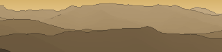
Von hier aus sind 108 benannte Gipfel zu sehen. Der höchste: Monte Cinto, 2706 m. Der fernste: Monte Zuccarello, 53,2 km Luftlinie.
Die höchsten Gipfel im Blickfeld
- Monte Cinto
- Capu Ciuntrone
- Pointe des Éboulis
- Punta Mufrena
- Capo al Berdato
- Capo Bianco
- Punta Minuta
- Capu Falu
- Paglia Orba
- A Maniccia
Was in welcher Richtung zu sehen ist
Capo al Berdato (2583 m, 20,6 km), Capo Bianco (2562 m, 21,5 km), Monte Padro (2390 m, 28,4 km), Capo Sellola (2273 m, 28 km), Capo Razino (2268 m, 21 km), Cima a i Mori (2180 m, 22,8 km), Punta di Castelli (2180 m, 5,3 km), Punta Jumentella (1966 m, 20,5 km) und 12 weitere.
Aiguille Grégovorius (2490 m, 0,3 km), Punta Lattiniccia (2413 m, 5,9 km), Monte Corbaia (1871 m, 7,9 km), Monte San Petrone (1767 m, 29,9 km), Punta di Caldane (1724 m, 27 km), Monte Muffraje (1712 m, 27,3 km), Cima a u Spazzolu (1234 m, 43,9 km), Pointe d'Evoli (1152 m, 46 km) und 3 weitere.
Monte Cardo (2453 m, 5,4 km), Punta Felicina (2437 m, 2,3 km), Punta da i Ciotti (2379 m, 3,5 km), Punta di Tana (1279 m, 15 km), Punta d'Eria (1222 m, 14,6 km).
Petra Niella (2316 m, 1,2 km), Punta dell'Oriente (2112 m, 15,3 km), Punta della Cappella (2041 m, 27,7 km), Punta Renosa (2008 m, 8,8 km), Monte Formicula (1981 m, 33 km), Punta di u Prati (1954 m, 26,3 km), Punta di Zorpi (1931 m, 14,7 km), Punta Bocca dell'Oro (1926 m, 24,9 km) und 8 weitere.
Monte d'Oro (2389 m, 9,4 km), Monte Renoso (2352 m, 18,5 km), Punta Capanella (2250 m, 19,3 km), Punta Bacinello (2247 m, 17,6 km), Pointe Migliarello (2240 m, 9,6 km), Pointe Muratello (2138 m, 9 km), Monte Incudine (2134 m, 42,6 km), Pointe de Casa (2120 m, 9,4 km) und 14 weitere.
A Maniccia (2496 m, 1,1 km), Mont Tretorre (1509 m, 14,1 km), Bocca larga (1425 m, 17,1 km), Punta Grossa (1049 m, 15,3 km).
Punta Mufrena (2590 m, 0,4 km), Punta alle Porte (2313 m, 4,4 km), Capo al Chiostro (2295 m, 4,1 km), Crête de Rinella (2266 m, 4,9 km), Capo alla Vacciola (2266 m, 4,4 km), Capitello (2237 m, 3,9 km), Cimatella (2101 m, 9,7 km), Capu a e Furcelle (2062 m, 10,4 km) und 1 weitere.
Monte Cinto (2706 m, 20,4 km), Capu Ciuntrone (2660 m, 20,5 km), Pointe des Éboulis (2607 m, 20,4 km), Punta Minuta (2556 m, 21,3 km), Capu Falu (2540 m, 20 km), Paglia Orba (2525 m, 20,4 km), Capo Tafonatu (2335 m, 20,9 km), Capu Tighiettu (2273 m, 20,7 km) und 13 weitere.
Über den Monte Rotondo
Der Monte Rotondo ist ein 2622 m hoher Zweitausender in den Alpen, in der Nähe von Monte Cinto, Punta Minuta, Punta Rossa. Plane deine Tour zum Monte Rotondo kostenlos mit Peakflow – auf echten Wegen, mit Höhenprofil, Wetter und Offline-Karte.
Monte Rotondo ist:Monte Rotondo (Korsika), ein Berg auf Korsika Monte Rotondo (Marken), ein Berg im italienischen Nationalpark Monti Sibillini Monte Rotondo (Abruzzen), ein Berg im italienischen Regionalpark Sirente-Velino eine Ortschaft in der Gemeinde Fondi in der Provinz Latium
Quelle der Beschreibung: Wikipedia (CC BY-SA), via Peakflow.
Wo der Gipfel steht
Gipfel in der Nähe

Häufige Fragen zum Monte Rotondo
Welche Berge sieht man vom Monte Rotondo?
Vom Gipfel aus sind 108 benannte Gipfel zu sehen. Die höchsten davon: Monte Cinto (2706 m, 20,4 km), Capu Ciuntrone (2660 m, 20,5 km), Pointe des Éboulis (2607 m, 20,4 km), Punta Mufrena (2590 m, 0,4 km), Capo al Berdato (2583 m, 20,6 km). Der fernste sichtbare Gipfel ist Monte Zuccarello in 53,2 km Luftlinie. Peakflow berechnet die Sicht aus dem Geländemodell und beschriftet sie im 360°-Rundblick.
Wie hoch ist der Monte Rotondo?
Der Monte Rotondo ist 2622 m hoch und liegt in den Alpen. In der Umgebung liegen Monte Cinto (2706 m), Punta Minuta (2556 m), Punta Rossa (2284 m).
Tour planen mit Peakflow
Route auf echten Wegen, farbiges Höhenprofil, Wetterfenster, Wasserquellen, Schneelage und GPX-Export – kostenlos, ohne Werbung, ohne Abo.
Jetzt Tour zum Monte Rotondo planen →
