Das sehen Sie vom Gipfel
Der Rundblick von der Punta di Lago Ghiacciato über volle 360 Grad, aus dem Höhenmodell gerechnet und mit den Namen der sichtbaren Gipfel beschriftet. Ziehen Sie das Bild zur Seite, der Regler blendet die Ferne aus.
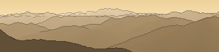
Von hier aus sind 164 benannte Gipfel zu sehen. Der höchste: Piz Bernina, 4049 m. Der fernste: Piz Bernina, 53,4 km Luftlinie.
Die höchsten Gipfel im Blickfeld
- Piz Bernina
- Piz Argient
- Pizzo Palù Centrale
- Monte Cevedale
- Palon de la Mare
- Punta San Matteo
- Thurwieserspitze - Punta Thurwieser
- Monte Vioz
- Punta Linke
- Punta Taviela
Was in welcher Richtung zu sehen ist
Monte Cevedale (3769 m, 26,4 km), Palon de la Mare (3703 m, 23,4 km), Punta San Matteo (3678 m, 18,6 km), Thurwieserspitze - Punta Thurwieser (3658 m, 31,8 km), Monte Vioz (3645 m, 22,1 km), Punta Linke (3630 m, 21,9 km), Punta Taviela (3612 m, 20,4 km), Punta Pedranzini (3599 m, 19,9 km) und 24 weitere.
Hinterer Eggenspitz - Cima Sternai (3443 m, 34 km), Mittlere Eggenspitze (3392 m, 33,8 km), Hinterer Schranspitz - Punta Martello (3357 m, 30,3 km), Hintere Rotspitze - Cima Rossa di Saent (3347 m, 30,5 km), Lorchenspitz - Cima Lorchen (3347 m, 34,6 km), Hasenöhrl - L'Orecchia di Lepre (3257 m, 43,9 km), Hinterer Nonnenspitz - Cima di Rabbi (3252 m, 34,2 km), Salentspitz - Cima di Saent (3215 m, 33,3 km) und 9 weitere.
Cima Presanella (3557 m, 8,4 km), Cima di Vermiglio (3459 m, 7,6 km), Monte Gabbiolo (3455 m, 7,4 km), Torre Scarazón (3370 m, 7,1 km), Cima Busazza (3325 m, 4,5 km), Anticima Est (3299 m, 4,8 km), Ago di Nardis (3291 m, 7,7 km), Torre Bignami (3289 m, 7,5 km) und 23 weitere.
V Molare (2968 m, 5,3 km), IV (2958 m, 6,3 km), II (2954 m, 6 km), Anticima Nord (2900 m, 3,2 km), Monte Stablel (2869 m, 5,2 km), Corno del Menicìgolo (2687 m, 4,8 km), Monte Ospedale (2681 m, 11,2 km), Punta Pino Masiero (2679 m, 4,8 km) und 5 weitere.
Dosson di Genova Meridionale (3439 m, 6,9 km), Corno di Cavento (3406 m, 8,6 km), La Tripla (3403 m, 7,1 km), Dosson di Genova Settentrionale (3379 m, 5,9 km), Anticima di Monte Fumo (3355 m, 7,6 km), Crozzon di Làres (3354 m, 7,4 km), Monte Folletto (3336 m, 10 km), Punta Attilio Calvi (3292 m, 8 km) und 6 weitere.
Monte Adamello (3539 m, 7,6 km), Corno Baitone (3331 m, 9,7 km), Punta del Venerocolo (3323 m, 4,2 km), Monte Narcanello (3291 m, 3,7 km), Monte Venezia (3290 m, 3,5 km), Monte dei Frati (3285 m, 4,1 km), Monte Mandrone (3283 m, 2,6 km), Roccia Baitone (3259 m, 11,2 km) und 4 weitere.
Piz Bernina (4049 m, 53,4 km), Piz Argient (3945 m, 51,6 km), Pizzo Palù Centrale (3900 m, 49,6 km), Punta Quinto Alpini (3333 m, 51,9 km), Pizzo Scalino (3323 m, 45,5 km), Pizzo Painale (3247 m, 45,1 km), Cima di Salimmo (3115 m, 3 km), Monte Aviolo (2881 m, 12,4 km) und 8 weitere.
Piz Cambrena (3607 m, 48,7 km), Cima de' Piazzi (3439 m, 31 km), Cima Viola (3374 m, 33,7 km), Piz Arlas (3367 m, 48,7 km), Monte Sobretta (3296 m, 22,8 km), Cima Orientale di Lago Spalmo (3291 m, 32,8 km), Pizzo di Dosdè (3280 m, 33,7 km), Punta di Pietra Rossa (3275 m, 15,6 km) und 21 weitere.
Über die Punta di Lago Ghiacciato
Die Punta di Lago Ghiacciato ist ein 3088 m hoher Dreitausender in Südtirol, in der Nähe von Punta di Segnale, Corno di Lago Scuro, Corno di Casamadre. Bis zum Gipfel führt kein markierter Wanderweg – der letzte Abschnitt verlangt alpine Erfahrung. Plane deine Tour zur Punta di Lago Ghiacciato kostenlos mit Peakflow – auf echten Wegen, mit Höhenprofil, Wetter und Offline-Karte.
Punta di Lago Ghiacciato ist ein Dreitausender in Südtirol und bietet eindrucksvolle Hochgebirgslandschaft mit Weitblick über die umliegenden Gipfel.
Quelle der Beschreibung: Wikipedia (CC BY-SA), via Peakflow.
Wo der Gipfel steht
Gipfel in der Nähe

Häufige Fragen zur Punta di Lago Ghiacciato
Welche Berge sieht man von der Punta di Lago Ghiacciato?
Vom Gipfel aus sind 164 benannte Gipfel zu sehen. Die höchsten davon: Piz Bernina (4049 m, 53,4 km), Piz Argient (3945 m, 51,6 km), Pizzo Palù Centrale (3900 m, 49,6 km), Monte Cevedale (3769 m, 26,4 km), Palon de la Mare (3703 m, 23,4 km). Der fernste sichtbare Gipfel ist Piz Bernina in 53,4 km Luftlinie. Peakflow berechnet die Sicht aus dem Geländemodell und beschriftet sie im 360°-Rundblick.
Wie hoch ist die Punta di Lago Ghiacciato?
Die Punta di Lago Ghiacciato ist 3088 m hoch und liegt in Südtirol. In der Umgebung liegen Punta di Segnale (3037 m), Corno di Lago Scuro (3164 m), Corno di Casamadre (3090 m).
Führt ein Wanderweg zur Punta di Lago Ghiacciato?
Nein. Zur Punta di Lago Ghiacciato führt kein markierter Wanderweg bis auf den Gipfel – der letzte Abschnitt verlangt alpine Erfahrung und eigene Beurteilung der Verhältnisse.
Tour planen mit Peakflow
Route auf echten Wegen, farbiges Höhenprofil, Wetterfenster, Wasserquellen, Schneelage und GPX-Export – kostenlos, ohne Werbung, ohne Abo.
Jetzt Tour zur Punta di Lago Ghiacciato planen →
