Das sehen Sie vom Gipfel
Der Rundblick vom Montagnole über volle 360 Grad, aus dem Höhenmodell gerechnet und mit den Namen der sichtbaren Gipfel beschriftet. Ziehen Sie das Bild zur Seite, der Regler blendet die Ferne aus.
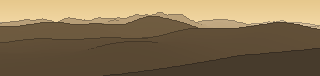
Von hier aus sind 108 benannte Gipfel zu sehen. Der höchste: Monte Velino, 2486 m. Der fernste: Colle Leporino, 54,8 km Luftlinie.
Die höchsten Gipfel im Blickfeld
- Monte Velino
- Monte Cafornia
- Monte di Sevice
- Monte Sirente
- Monte Costognillo
- La Castellina
- Costone
- Punta Macerola
- Costone Occidentale
- Monte Magnola
Was in welcher Richtung zu sehen ist
Monte Terminillo (2217 m, 50,9 km), Monte di Cambio (2081 m, 54,7 km), Cima di Prato Cristoforo (1975 m, 50,7 km), Colle della Fungara (1887 m, 37,3 km), Monte Nurietta (1884 m, 35,2 km), Terminilluccio (1864 m, 49,6 km), Monte Giano (1817 m, 45 km), Colle Leporino (1756 m, 54,8 km) und 3 weitere.
Monte Velino (2486 m, 23,9 km), Monte Cafornia (2424 m, 24,6 km), Monte di Sevice (2355 m, 23,7 km), Monte Costognillo (2339 m, 23,9 km), Costone (2271 m, 26,4 km), Costone Occidentale (2239 m, 26,2 km), Monte Magnola (2220 m, 29,2 km), Cimata della Selva del Coco (2187 m, 26,6 km) und 10 weitere.
Monte Sirente (2348 m, 41 km), La Castellina (2277 m, 41,6 km), Punta Macerola (2258 m, 40,1 km), Monte di Canale (2151 m, 42,5 km), Sperone dei Tiburtini (2128 m, 39,2 km), Monte Tino (Serra Di Celano) (1921 m, 35,1 km), Monte Cacume (1660 m, 3,9 km), Monte San Pietro (1535 m, 40,2 km).
Monte Crepacuore (1997 m, 26,8 km), Peschio della Cornacchia (1983 m, 27,9 km), Cima di Monna Moschino (1962 m, 25,1 km), Peschio delle Ciavole (1959 m, 28,5 km), Cima delle coste del Tarino (1895 m, 16,6 km), Monte Pratiglio (1884 m, 25,2 km), Monte Autore (1855 m, 9,4 km), La Torretta (1799 m, 1,6 km) und 3 weitere.
Monte Pelato (1611 m, 6,6 km), La Morra (1606 m, 8,7 km), Monte Calvo (1591 m, 8,1 km), Monte Camposecco (1494 m, 3,1 km), Monte Malaina (1482 m, 47,1 km), Colle Faito (1476 m, 3,9 km), Monte Lupone (1378 m, 44,4 km), Monte Rinsaturo (1166 m, 43,6 km).
Monte Castell'Amato (1480 m, 6,3 km), Monte Costasole (1253 m, 14,4 km), Colle Corizza (1245 m, 5,4 km), Monte Guadagnolo (1218 m, 21,7 km), Monte Cerella (1205 m, 21,3 km), Il Monte (1192 m, 13,6 km), Monte Vincenzo (1144 m, 21,4 km), Monte Piccione (1135 m, 21,2 km) und 10 weitere.
Monte Pellecchia (1370 m, 24,2 km), Cima Fidene (1361 m, 24 km), Pizzo Pellecchia (1331 m, 23,5 km), Colle Volubrella (1282 m, 4,9 km), Colle Valle del Lago (1280 m, 24,4 km), Monte Gennaro (1272 m, 27,9 km), Monte Campitello (1197 m, 24,5 km), Monte Guardia (1184 m, 24,2 km) und 13 weitere.
Monte Navegna (1508 m, 24,5 km), Monte Cervia (1431 m, 19,2 km), Monte Aquilone (1320 m, 28,6 km), Monte Pizzuto (1288 m, 48,4 km), Monte Macchia Gelata (1258 m, 49,7 km), Monte Porco Morto (1258 m, 52 km), Monte Menicoccio (1204 m, 47,5 km), Cima Casarene (1192 m, 25 km) und 5 weitere.
Über das Montagnole
Das Montagnole ist ein 1621 m hoher Alpengipfel in den Alpen, in der Nähe von Monte Rosa. Plane deine Tour zum Montagnole kostenlos mit Peakflow – auf echten Wegen, mit Höhenprofil, Wetter und Offline-Karte.
Montagnole ist eine französische Gemeinde mit 1038 Einwohnern (Stand 1. Januar 2023) im Département Savoie in der Region Auvergne-Rhône-Alpes.
Quelle der Beschreibung: Wikipedia (CC BY-SA), via Peakflow.
Wo der Gipfel steht
Gipfel in der Nähe

Häufige Fragen zum Montagnole
Welche Berge sieht man vom Montagnole?
Vom Gipfel aus sind 108 benannte Gipfel zu sehen. Die höchsten davon: Monte Velino (2486 m, 23,9 km), Monte Cafornia (2424 m, 24,6 km), Monte di Sevice (2355 m, 23,7 km), Monte Sirente (2348 m, 41 km), Monte Costognillo (2339 m, 23,9 km). Der fernste sichtbare Gipfel ist Colle Leporino in 54,8 km Luftlinie. Peakflow berechnet die Sicht aus dem Geländemodell und beschriftet sie im 360°-Rundblick.
Wie hoch ist das Montagnole?
Das Montagnole ist 1621 m hoch und liegt in den Alpen. In der Umgebung liegen Monte Rosa (1090 m).
Tour planen mit Peakflow
Route auf echten Wegen, farbiges Höhenprofil, Wetterfenster, Wasserquellen, Schneelage und GPX-Export – kostenlos, ohne Werbung, ohne Abo.
Jetzt Tour zum Montagnole planen →
