Das sehen Sie vom Gipfel
Der Rundblick vom Monte Bello über volle 360 Grad, aus dem Höhenmodell gerechnet und mit den Namen der sichtbaren Gipfel beschriftet. Ziehen Sie das Bild zur Seite, der Regler blendet die Ferne aus.
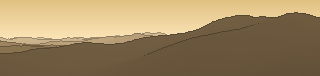
Von hier aus sind 126 benannte Gipfel zu sehen. Der höchste: Monte Marmagna, 1852 m. Der fernste: Monte Corno, 45,3 km Luftlinie.
Die höchsten Gipfel im Blickfeld
- Monte Marmagna
- Monte Orsaro
- Monte Maggiorasca
- Monte Bue
- Monte Nero
- Monte Picchetto
- Monte Penna
- Monte Croce Martincano
- Monte Ragola
- Monte Aiona
Was in welcher Richtung zu sehen ist
Monte Menegosa (1356 m, 14,3 km), Monte la Morfassina (1336 m, 15,7 km), Monte Santa Franca (1321 m, 16,1 km), Monte Osero (1301 m, 20 km), il Guttarello (1281 m, 15,1 km), Monte la Penna (1177 m, 17 km), Monte Cappello (1104 m, 7,3 km), Groppo Sidoli (1072 m, 7,1 km) und 1 weitere.
Monte di Lama (1342 m, 13,2 km), Cima di Morfasso (1323 m, 14,5 km), Monte Carameto (1318 m, 17,4 km), Colle Il Castellaccio (1308 m, 12,8 km), Groppo di Gora (1302 m, 13,1 km), Monte Crodolo (1256 m, 11,5 km), Monte Pratobello (1191 m, 18,4 km), Ronco Frera (1172 m, 17,7 km) und 9 weitere.
Monte Caio (1575 m, 45 km), Monte Cervellino (1493 m, 36,6 km), Punta Fegni (1485 m, 44,3 km), Bocca Spiaggi (1406 m, 36,5 km), Groppo Cardello (1399 m, 44,6 km), Monte Cavalcalupo (1368 m, 38 km), Maestà di Graiana (1335 m, 36 km), Monte Montagnana (1311 m, 39,1 km) und 19 weitere.
Monte Marmagna (1852 m, 37,1 km), Monte Orsaro (1830 m, 36 km), Tecchio dei Merli (1643 m, 45 km), Fabei (1590 m, 24,1 km), Groppo Fosco (1585 m, 40,8 km), Monte Colombo (1562 m, 24,4 km), Monte la Pelata (1555 m, 25,6 km), Monte Pitone (1551 m, 24,3 km) und 8 weitere.
Monte Gottero (1639 m, 24,6 km), Monte Penato (1571 m, 23,6 km), Monte Teccio al Sole (1533 m, 24,2 km), Monte Pizzofreddo (1517 m, 24,6 km), Il Pennale (1508 m, 23,6 km), Monte Zuccone (1421 m, 15,8 km), Monte Orocco (1372 m, 10,3 km), Raspalupo (1312 m, 14,9 km) und 15 weitere.
Monte Penna (1736 m, 13,8 km), Monte Croce Martincano (1722 m, 9,8 km), Monte Aiona (1701 m, 16,6 km), Monte Aiona Cima Nord (1692 m, 16,1 km), Monte Nero (1675 m, 15,4 km), Monte Le Trevine - cima ovest (1661 m, 13,4 km), Monte Cantomoro (1654 m, 15,1 km), Monte Le Trevine - cima est (1651 m, 13,4 km) und 11 weitere.
Monte Maggiorasca (1798 m, 9,5 km), Monte Bue (1772 m, 9,1 km), Monte Nero (1752 m, 7,7 km), Monte Picchetto (1744 m, 9,8 km), Monte Ragola (1712 m, 5,3 km), Monte Roncalla (1685 m, 10,8 km), Monte Ciapa Liscia (1682 m, 10,5 km), Monte Ragolino (1647 m, 4,2 km) und 5 weitere.
Monte Camulara (1564 m, 4,9 km), Monte Pravera (1261 m, 2,7 km).
Über den Monte Bello
Der Monte Bello ist ein 1205 m hoher Alpengipfel in den Alpen, in der Nähe von Monte della Madonna, Monte Zucchero, Monte Piano. Plane deine Tour zum Monte Bello kostenlos mit Peakflow – auf echten Wegen, mit Höhenprofil, Wetter und Offline-Karte.
Montebello oder Monte Bello heißen folgende geographische Objekte: Gebirgslage: Montebello 1958 m ü. M. im Val Bernina, Aussichtspunkt nahe der Montebello-Kurve der Berninabahn Gemeinden, Orte: Monte Bello (Tucumán), Ort in der Provinz Tucumán, Argentinien Montebello della Battaglia, italienische Gemeinde in der Lombardei Montebello Ionico, it...
Quelle der Beschreibung: Wikipedia (CC BY-SA), via Peakflow.
Wo der Gipfel steht
Gipfel in der Nähe

Häufige Fragen zum Monte Bello
Welche Berge sieht man vom Monte Bello?
Vom Gipfel aus sind 126 benannte Gipfel zu sehen. Die höchsten davon: Monte Marmagna (1852 m, 37,1 km), Monte Orsaro (1830 m, 36 km), Monte Maggiorasca (1798 m, 9,5 km), Monte Bue (1772 m, 9,1 km), Monte Nero (1752 m, 7,7 km). Der fernste sichtbare Gipfel ist Monte Corno in 45,3 km Luftlinie. Peakflow berechnet die Sicht aus dem Geländemodell und beschriftet sie im 360°-Rundblick.
Wie hoch ist der Monte Bello?
Der Monte Bello ist 1205 m hoch und liegt in den Alpen. In der Umgebung liegen Monte della Madonna (1060 m), Monte Zucchero (1032 m), Monte Piano (1150 m).
Tour planen mit Peakflow
Route auf echten Wegen, farbiges Höhenprofil, Wetterfenster, Wasserquellen, Schneelage und GPX-Export – kostenlos, ohne Werbung, ohne Abo.
Jetzt Tour zum Monte Bello planen →
