Das sehen Sie vom Gipfel
Der Rundblick vom Monte Maggiorasca über volle 360 Grad, aus dem Höhenmodell gerechnet und mit den Namen der sichtbaren Gipfel beschriftet. Ziehen Sie das Bild zur Seite, der Regler blendet die Ferne aus.
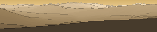
Von hier aus sind 158 benannte Gipfel zu sehen. Der höchste: Monte Sillara, 1861 m. Der fernste: Monte Sporno, 55 km Luftlinie.
Die höchsten Gipfel im Blickfeld
- Monte Sillara
- Monte Marmagna
- Monte Orsaro
- Monte Bocco
- Monte Penna
- Monte Lesima
- Monte Ragola
- Monte Aiona
- Monte Ebro
- Monte Chiappo
Was in welcher Richtung zu sehen ist
Groppo delle Ali (1698 m, 1,1 km), Dente della Cipolla (1660 m, 1,1 km), Monte Aserei (1431 m, 16,7 km), Monte della Guardia (1304 m, 15,6 km), Monte Osero (1301 m, 22,5 km), Groppi di Lavezzera (1286 m, 14,5 km), Monte Pietra di Corvo (1078 m, 32 km), Monte Rondanara (858 m, 9,1 km).
Monte Ragola (1712 m, 5,7 km), Monte Ragolino (1647 m, 6,7 km), Poggio dell'Orlo (1509 m, 7,3 km), Monte Zovallo (1491 m, 4,2 km), Monte Prelo (1460 m, 6,8 km), Groppo di Pertuso (1385 m, 6,1 km), Monte di Lama (1342 m, 21,1 km), Monte la Morfassina (1336 m, 22,4 km) und 8 weitere.
Monte Orsaro (1830 m, 42,8 km), Monte Fosco (1680 m, 43 km), Groppo Fosco (1585 m, 48 km), Monte Caio (1575 m, 53,1 km), Monte Molinatico (1550 m, 31 km), Monte Cervellino (1493 m, 45,2 km), Punta Fegni (1485 m, 52,3 km), Costa Agucchia (1452 m, 12 km) und 26 weitere.
Monte Sillara (1861 m, 49,9 km), Monte Marmagna (1852 m, 43,7 km), Monte Bocco (1790 m, 53,4 km), Tecchio dei Merli (1643 m, 51,3 km), Monte Gottero (1639 m, 25,7 km), Monte Tomarlo (1601 m, 2,6 km), Fabei (1590 m, 27,3 km), Monte Penato (1571 m, 26 km) und 17 weitere.
Monte Penna (1736 m, 7,7 km), Monte Nero (1675 m, 8,4 km), Monte Le Trevine - cima ovest (1661 m, 7,8 km), Monte Cantomoro (1654 m, 7,9 km), Monte Le Trevine - cima est (1651 m, 8,1 km), Monte Chiodo (1465 m, 5,6 km), Monte Martellina (1443 m, 2,2 km), Monte Romezzano (1422 m, 5,2 km) und 4 weitere.
Monte Aiona (1701 m, 8,6 km), Poggio delle Lame (1634 m, 9 km), Monte delle Lame (1595 m, 9,6 km), Monte Cerighetto (1527 m, 7,6 km), Monte Pietre dello Zucchero (1303 m, 9,9 km), Monte Pianazze (1275 m, 14,6 km), Monte Castelmare (1229 m, 6,4 km), Monte Rocchette (1186 m, 6 km) und 5 weitere.
Monte Carmo (1642 m, 24,1 km), Poggio Rondino (1630 m, 24,6 km), Monte Antola (1597 m, 27,1 km), Monte delle Tre Croci (1556 m, 25,5 km), Monte Oramara (1522 m, 9,1 km), Monte Cremado (1513 m, 27,3 km), Monte Montarlone (1501 m, 10,4 km), Monte Pio di Brigneto (1462 m, 23,4 km) und 18 weitere.
Monte Lesima (1724 m, 23,2 km), Monte Ebro (1700 m, 29,8 km), Monte Chiappo (1699 m, 27,4 km), Monte Roncalla (1685 m, 2,3 km), Monte Cavalmurone (1670 m, 25,5 km), Monte Legnà (1669 m, 25,7 km), Monte Groppo Rosso (1595 m, 2,3 km), Monte Crociglia (1578 m, 4,7 km) und 16 weitere.
Über den Monte Maggiorasca
Der Monte Maggiorasca ist ein 1798 m hoher Alpengipfel in den Alpen, in der Nähe von Monte Aiona, Monte Castello, Monte Carmo. Der markierte Weg zum Gipfel hat die SAC-Schwierigkeit T2 Bergwandern. Plane deine Tour zum Monte Maggiorasca kostenlos mit Peakflow – auf echten Wegen, mit Höhenprofil, Wetter und Offline-Karte.
Der Monte Maggiorasca ist der höchste Berg im Ligurischen Apennin und liegt zwischen der Metropolitanstadt Genua und der Provinz Parma in den beiden Regionen Ligurien und Emilia-Romagna. Er dominiert das Val d’Aveto (siehe auch Naturpark Aveto) mit der Gemeinde Santo Stefano d’Aveto, das Val Nure mit der Gemeinde Ferriere und das Valle del Ceno ...
Quelle der Beschreibung: Wikipedia (CC BY-SA), via Peakflow.
Wo der Gipfel steht
Gipfel in der Nähe

Häufige Fragen zum Monte Maggiorasca
Welche Berge sieht man vom Monte Maggiorasca?
Vom Gipfel aus sind 158 benannte Gipfel zu sehen. Die höchsten davon: Monte Sillara (1861 m, 49,9 km), Monte Marmagna (1852 m, 43,7 km), Monte Orsaro (1830 m, 42,8 km), Monte Bocco (1790 m, 53,4 km), Monte Penna (1736 m, 7,7 km). Der fernste sichtbare Gipfel ist Monte Sporno in 55 km Luftlinie. Peakflow berechnet die Sicht aus dem Geländemodell und beschriftet sie im 360°-Rundblick.
Wie hoch ist der Monte Maggiorasca?
Der Monte Maggiorasca ist 1798 m hoch und liegt in den Alpen. In der Umgebung liegen Monte Aiona (1701 m), Monte Castello (1052 m), Monte Carmo (1166 m).
Wie schwierig ist der Aufstieg zum Monte Maggiorasca?
Der markierte Weg zum Monte Maggiorasca ist nach der SAC-Bergwanderskala mit T2 Bergwandern bewertet. Das verlangt Trittsicherheit auf teils steilem Gelände.
Tour planen mit Peakflow
Route auf echten Wegen, farbiges Höhenprofil, Wetterfenster, Wasserquellen, Schneelage und GPX-Export – kostenlos, ohne Werbung, ohne Abo.
Jetzt Tour zum Monte Maggiorasca planen →
