Das sehen Sie vom Gipfel
Der Rundblick vom Monte Carmo über volle 360 Grad, aus dem Höhenmodell gerechnet und mit den Namen der sichtbaren Gipfel beschriftet. Ziehen Sie das Bild zur Seite, der Regler blendet die Ferne aus.
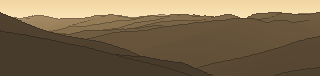
Von hier aus sind 81 benannte Gipfel zu sehen. Der höchste: Monte Maggiorasca, 1798 m. Der fernste: Monte Bue, 25,5 km Luftlinie.
Die höchsten Gipfel im Blickfeld
- Monte Maggiorasca
- Monte Bue
- Monte Aiona
- Groppo delle Ali
- Monte Aiona Cima Sud
- Monte Antola
- Monte Groppo Rosso
- Monte Crociglia
- Monte Carevolo
- Monte Montarlone
Was in welcher Richtung zu sehen ist
Monte Antola (1597 m, 9,6 km), Monte Duso (1451 m, 7,1 km), Monte Prelà (1407 m, 5,8 km).
Monte Crociglia (1578 m, 24,3 km), Monte Carevolo (1552 m, 25,4 km), Monte Montarlone (1501 m, 16,2 km), Monte Bufalora (1440 m, 17,8 km), Monte Dego (1427 m, 17,7 km), Monte Roccabruna (1418 m, 13,5 km), Monte Vernallo (1072 m, 9,1 km), Monte Friciallo (1061 m, 1,2 km).
Monte Maggiorasca (1798 m, 25,1 km), Monte Bue (1772 m, 25,5 km), Monte Aiona (1701 m, 20,5 km), Groppo delle Ali (1698 m, 25,4 km), Monte Aiona Cima Sud (1688 m, 20,4 km), Monte Groppo Rosso (1595 m, 23,7 km), Monte Castello Fante (1391 m, 12,3 km), Monte Gifarco (1380 m, 13,1 km) und 7 weitere.
Monte Ramaceto (1345 m, 12,1 km), Monte Ramaceto ovest (1318 m, 11,7 km), Monte Caucaso (1250 m, 5,1 km), Monte Larnaia (1185 m, 4,2 km), Rocca Cavallina (1110 m, 3,8 km), Monte Bocco (1092 m, 2,6 km), Monte Castello (666 m, 16 km), Monte Zuccarello (619 m, 16,4 km).
Monte Carpena (907 m, 2,9 km), Monte Rocio (852 m, 5,8 km), Monte Borghigliano (846 m, 2 km), Monte Manico del Lume (801 m, 11 km), Rocca Cavello (797 m, 4,9 km), Zuccarello (777 m, 4,1 km), Monte Pegge (774 m, 12,2 km), Monte Spina (743 m, 5,3 km) und 8 weitere.
Monte Croce dei Fò (973 m, 10 km), Monte Perdono (913 m, 2,3 km), Monte Bado (911 m, 9,8 km), Monte di Traso (908 m, 10,6 km), Cima dei Runchi (901 m, 11 km), Monte Becco (894 m, 10,5 km), Monte Pernaceto (883 m, 10,6 km), Monte Croce di Bragalla (864 m, 7,6 km) und 13 weitere.
Monte Montaldo (1136 m, 1 km), Monte Lavagnola (1113 m, 1,7 km), Monte Bragaglino (1091 m, 2 km), Colle nord Monte Lavagnola (1080 m, 1,7 km), Monte Candelozzo (1037 m, 8,6 km), Monte la Colla (898 m, 4,2 km).
Monte Carmo (1325 m, 11,5 km), Monte Spigo (1126 m, 4,6 km), Monte Liprando (1122 m, 9,5 km), Monte Corsica (1096 m, 0,6 km).
Über den Monte Carmo
Der Monte Carmo ist ein 1032 m hoher Alpengipfel in den Alpen, in der Nähe von Monte Carmo, Monte Antola, Monte Carmo. Der markierte Weg zum Gipfel hat die SAC-Schwierigkeit T2 Bergwandern. Plane deine Tour zum Monte Carmo kostenlos mit Peakflow – auf echten Wegen, mit Höhenprofil, Wetter und Offline-Karte.
Der Monte Carmo ist ein 1641 Meter hoher Berg des Ligurischen Apennins. Er befindet sich auf dem Treffpunkt dreier italienischer Regionen: Ligurien, Piemont und Emilia-Romagna.
Quelle der Beschreibung: Wikipedia (CC BY-SA), via Peakflow.
Wo der Gipfel steht
Gipfel in der Nähe

Häufige Fragen zum Monte Carmo
Welche Berge sieht man vom Monte Carmo?
Vom Gipfel aus sind 81 benannte Gipfel zu sehen. Die höchsten davon: Monte Maggiorasca (1798 m, 25,1 km), Monte Bue (1772 m, 25,5 km), Monte Aiona (1701 m, 20,5 km), Groppo delle Ali (1698 m, 25,4 km), Monte Aiona Cima Sud (1688 m, 20,4 km). Der fernste sichtbare Gipfel ist Monte Bue in 25,5 km Luftlinie. Peakflow berechnet die Sicht aus dem Geländemodell und beschriftet sie im 360°-Rundblick.
Wie hoch ist der Monte Carmo?
Der Monte Carmo ist 1032 m hoch und liegt in den Alpen. In der Umgebung liegen Monte Carmo (1012 m), Monte Antola (1597 m), Monte Carmo (1325 m).
Wie schwierig ist der Aufstieg zum Monte Carmo?
Der markierte Weg zum Monte Carmo ist nach der SAC-Bergwanderskala mit T2 Bergwandern bewertet. Das verlangt Trittsicherheit auf teils steilem Gelände.
Tour planen mit Peakflow
Route auf echten Wegen, farbiges Höhenprofil, Wetterfenster, Wasserquellen, Schneelage und GPX-Export – kostenlos, ohne Werbung, ohne Abo.
Jetzt Tour zum Monte Carmo planen →
