Das sehen Sie vom Gipfel
Der Rundblick vom Monte Carmo über volle 360 Grad, aus dem Höhenmodell gerechnet und mit den Namen der sichtbaren Gipfel beschriftet. Ziehen Sie das Bild zur Seite, der Regler blendet die Ferne aus.
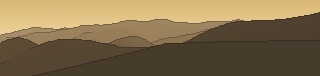
Von hier aus sind 116 benannte Gipfel zu sehen. Der höchste: Monte Ebro, 1700 m. Der fernste: Monte Gottero, 51,6 km Luftlinie.
Die höchsten Gipfel im Blickfeld
- Monte Ebro
- Monte Chiappo
- Monte Legnà
- Monte Cosfrone
- Monte Prenardo
- Monte Alfeo
- Monte Carmo
- Monte Gottero
- Monte Antola
- Monte Panà
Was in welcher Richtung zu sehen ist
Monte Cosfrone (1665 m, 14,2 km), Monte Panà (1562 m, 15,2 km), Monte Roncasso (1536 m, 13,9 km), Monte Giarolo (1473 m, 17 km), Monte Gropà (1420 m, 16,1 km), Monte Sopra Costa (1280 m, 2,2 km), Monte Bossola (1137 m, 8,1 km), Monte Castello (1092 m, 4,5 km) und 4 weitere.
Monte Ebro (1700 m, 14 km), Monte Chiappo (1699 m, 14,8 km), Monte Legnà (1669 m, 11,4 km), Monte Prenardo (1655 m, 14,6 km), Monte Alfeo (1651 m, 15,3 km), Monte Carmo (1642 m, 9,2 km), Monte Porreio (1533 m, 10,4 km), Monte Propiano (1413 m, 5,2 km) und 1 weitere.
Monte Antola (1597 m, 4 km), Monte delle Tre Croci (1556 m, 5,8 km), Monte Cremado (1513 m, 4 km), Monte Arvego (1376 m, 2,8 km).
Monte Gottero (1639 m, 51,6 km), Monte Duso (1451 m, 5 km), Monte Prelà (1407 m, 6 km), Monte Ramaceto ovest (1318 m, 22,8 km), Monte Sotto Garzo (1288 m, 3,1 km), Monte Caucaso (1250 m, 16,6 km), Monte Larnaia (1185 m, 15,3 km), Monte Lavagnola (1113 m, 10,6 km) und 6 weitere.
Monte Liprando (1122 m, 3,9 km), Monte Pareto (1107 m, 1,4 km), Monte Pezzu (1061 m, 3,7 km), Monte Candelozzo (1037 m, 11,4 km), Monte di Pezza (1029 m, 4,2 km), Monte Moro (986 m, 6,2 km), Monte Croce dei Fò (973 m, 16,8 km), il Poggio (959 m, 4,5 km) und 10 weitere.
Monte Rama (1148 m, 41,5 km), Monte Badriga (1104 m, 4,2 km), Monte Garego (1033 m, 5,1 km), Monte Alpesisa (984 m, 11,4 km), Monte della Croce (961 m, 5,2 km), Monte Banca (928 m, 6,1 km), Dente di Mareta (900 m, 2,5 km), Monte Bonetto (772 m, 9,8 km) und 7 weitere.
Monte Beigua (1287 m, 45,2 km), Monte Ermetta (1267 m, 45,9 km), Monte Grosso (1265 m, 44,8 km), Monte Riondo (1254 m, 0,7 km), Bric Damè (1200 m, 42,1 km), Monte Figne (1172 m, 21 km), Monte Alpisella (1155 m, 1,6 km), Monte Taccone (1113 m, 19,9 km) und 23 weitere.
Bric delle Camere (1018 m, 9,2 km), Monte Cravì (990 m, 6,8 km), Bric del Pra (981 m, 2,9 km), Bric di Cravello (958 m, 5,9 km), Bric Castellazzo (942 m, 11 km), Bric Il Castelluccio (916 m, 2,2 km), Bric dell'Aiuola (873 m, 9 km), Monte La Croce (824 m, 13,8 km) und 5 weitere.
Über den Monte Carmo
Der Monte Carmo ist ein 1325 m hoher Alpengipfel in den Alpen, in der Nähe von Monte Antola, Monte Castello, Monte Carmo. Der markierte Weg zum Gipfel hat die SAC-Schwierigkeit T2 Bergwandern. Plane deine Tour zum Monte Carmo kostenlos mit Peakflow – auf echten Wegen, mit Höhenprofil, Wetter und Offline-Karte.
Der Monte Carmo ist ein 1641 Meter hoher Berg des Ligurischen Apennins. Er befindet sich auf dem Treffpunkt dreier italienischer Regionen: Ligurien, Piemont und Emilia-Romagna.
Quelle der Beschreibung: Wikipedia (CC BY-SA), via Peakflow.
Wo der Gipfel steht
Gipfel in der Nähe

Häufige Fragen zum Monte Carmo
Welche Berge sieht man vom Monte Carmo?
Vom Gipfel aus sind 116 benannte Gipfel zu sehen. Die höchsten davon: Monte Ebro (1700 m, 14 km), Monte Chiappo (1699 m, 14,8 km), Monte Legnà (1669 m, 11,4 km), Monte Cosfrone (1665 m, 14,2 km), Monte Prenardo (1655 m, 14,6 km). Der fernste sichtbare Gipfel ist Monte Gottero in 51,6 km Luftlinie. Peakflow berechnet die Sicht aus dem Geländemodell und beschriftet sie im 360°-Rundblick.
Wie hoch ist der Monte Carmo?
Der Monte Carmo ist 1325 m hoch und liegt in den Alpen. In der Umgebung liegen Monte Antola (1597 m), Monte Castello (1092 m), Monte Carmo (1642 m).
Wie schwierig ist der Aufstieg zum Monte Carmo?
Der markierte Weg zum Monte Carmo ist nach der SAC-Bergwanderskala mit T2 Bergwandern bewertet. Das verlangt Trittsicherheit auf teils steilem Gelände.
Tour planen mit Peakflow
Route auf echten Wegen, farbiges Höhenprofil, Wetterfenster, Wasserquellen, Schneelage und GPX-Export – kostenlos, ohne Werbung, ohne Abo.
Jetzt Tour zum Monte Carmo planen →
